
Route description
In the summer of 2002 the ecological voluntary association Club New Age onlus in collaboration with Pro Vinaio and under the patronage of the Municipality of Lauco, created an equipped path inside the gorge of the Vinadia stream in the locality of Vinaio.

The route starts from the hamlet of the same name and descends along a recently arranged path of the bed of the Vinadia stream, until it reaches the tributary, the Picchions stream.
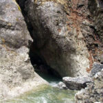
Near the tributary it is possible to appreciate an imposing view of a monolithic rocky tooth detached from one side of the river and lying on the opposite wall.
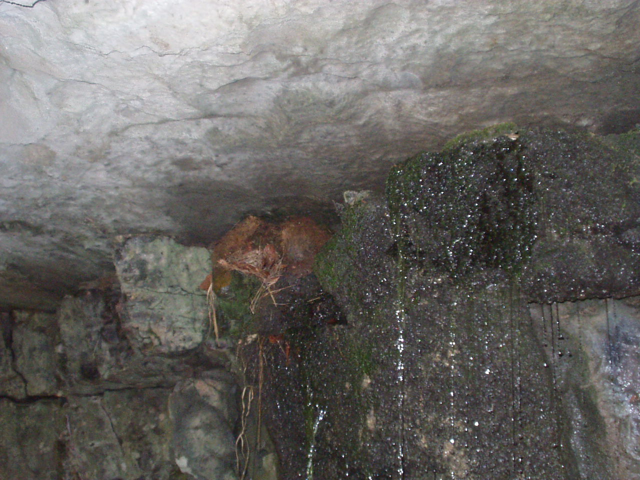 A few meters upstream from the confluence resounds the din of the Picchions waterfall (one of the most representative and dear to villagers) attraction among whose ravines the water blackbird nests.
Shortly after the meeting with the tributary, the track splits in two: one section descends into the gorge and the other goes up the left orographic bank of the Picchions until it returns to the village.
Leaving the uphill track that we will retrace on our return, we descend along the riverbed to enter the depths of the gorge.
 After a few hundred meters we will find the first aided section, which on steps and steel ropes allows us to cross a deep pool that hinders the passage.
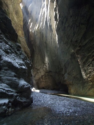
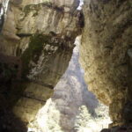
Plunging the legs up to the knee, we continue with a small exploration of an artificial gallery created in the left orographic wall of the slope, exiting the latter we cross the narrowest part of the path in a narrow ravine where the walls are a few meters away and the light penetrates with difficulties, giving us very suggestive light games.
In this stretch it is necessary to immerse yourself completely in the water in order to continue.
Con continue aperture e chiusure delle pareti il percorso avanza, dopo salti rocciosi opportunamente attrezzati giungiamo alla fine dell'itinerario dove il torrente si getta in un salto di qualche decina di metri creando una fragorosa cascata d'acqua.
Da qui in poi la discesa è riservata agli appassionati di torrentismo, che muniti della attrezzatura idonea e dopo qualche ora di discese mozzafiato possono raggiungere Villa Santina e la confluenza con il Tagliamento.
With continuous openings and closings of the walls the path advances, after suitably aided rocky jumps we reach the end of the itinerary where the stream flows into a jump of a few tens of meters creating a thunderous waterfall.
From here on, the descent is reserved for canyoning enthusiasts, who equipped with suitable equipment and after a few hours of breathtaking descents can reach Villa Santina and the confluence with the Tagliamento.
We linger a few moments to enjoy the majestic view and then set off towards the return.
Leaving the Forra and returning to the intersection mentioned above, we turn right still ahead, the path climbs up a steep slope that bypasses the waterfall and allows us to climb up to the top.
Following the marked track again, you will reenter the riverbed where you can admire particular examples of river erosion that have created curiously smooth rock tables.
The track climbs until it reaches the bridge of the Buttea municipal road, after which it continues in a sort of natural channel embedded and eroded into the rock.
After a few tenths of meters, before an impracticable stretch, the path leaves the riverbed on its orographic right, passes through the woods and joining the road above it leads to the town closing the ring.
The route is feasible in the months of July - August with adequate equipment for the railways.
Read carefully the safety instructions on the home page for hikers.